| Directions
To our knowledge, this waterfall is
not publicly accessible.
|
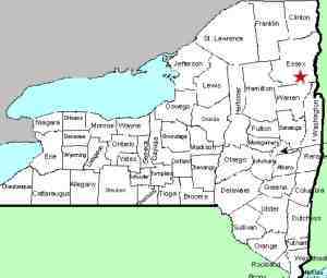
| County: |
Essex |
| Town: |
North Hudson |
| USGS Map: |
Paradox Lake |
| Waterway: |
Schroon River |
| Latitude: |
N 43°
56' 12" |
| Longitude: |
W 73°
44' 28" |
| Drop: |
NA |
| Type: |
NA |
| Region: |
US 9 just
south of North Hudson |
| Parking: |
NA |
| Trail type: |
NA |
| Length of
hike: |
NA |
| Difficulty: |
NA |
| Accessibility: |
Private |
| Name: |
Official |
|
According to USGS topographical maps, this waterfall is located
on the west side of US 9, about 3 miles north of Schroon Falls and
1-1/4 mile south of the hamlet of North River, in the area of the
Schroon River Cemetery.
The maps do not indicate a trail and we saw no obvious trailhead
through that area and there was no signage for it. It would
appear that this location is only accessible through private land
or by the river. According to Tony Goodwin, Executive Director
of the Adirondack Trail Improvement Society, this stretch is "barely
a rapids and certainly not a waterfall. Canoeable by the unskilled
at low water, it is just a quickening of the current at high water."
We received an e-mail from another individual who has canoed this
section of the Schroon River and they agreed with that assessment.
Interestingly, Linsey Falls is listed on the USGS Geographic Names
Information System (GNIS), which means it is an officially named
waterfall!
If anyone has any pictures or this waterfall, we would be very
interested in hearing
from you.
The Schroon River flows through Schroon Lake and then continues
its journey to the Hudson River just outside of the village of Warrensburg.
The Hudson flows into the Atlantic Ocean in New York City.
Latest update: March 20, 2014
|


