| Directions
From the village of Adams, take US
11 south and take a right on CR 85. After crossing
under I-81, the first intersection will be CR 91.
Take a left and in a short distance there is a bridge.
This waterfall will be in view upstream.
|
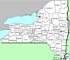
| County: |
Jefferson |
| Town: |
Ellisburg |
| USGS Map: |
Adams |
| Waterway: |
South Sandy Creek |
| Latitude: |
N 43°
45' 46" |
| Longitude: |
W 76°
04' 01" |
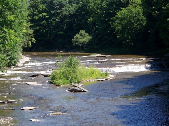
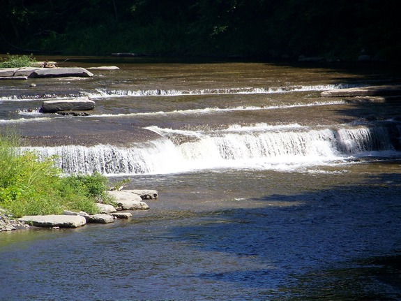
| Drop: |
~ 3' |
| Type: |
Curtain cascade |
| Region: |
South of Adams |
| Parking: |
Roadside |
| Trail type: |
Roadside |
| Length of hike: |
Roadside |
| Difficulty: |
Easy |
| Accessibility: |
Public |
| Name: |
Charted/Unnamed |
|
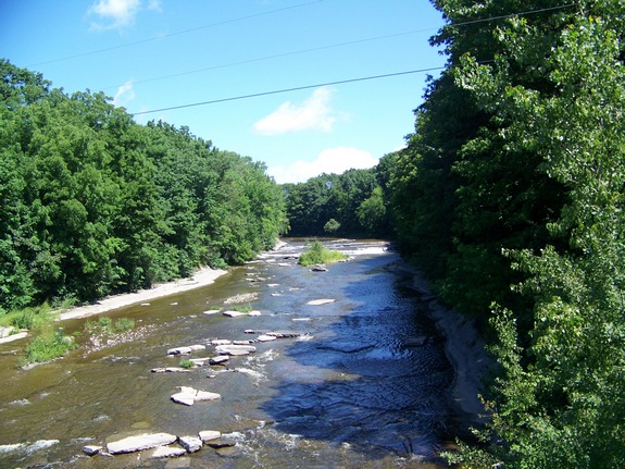
Although topographical
maps locate these falls a little further upstream, we were told
by residents of a home adjacent to the South Sandy Creek that these
falls are the only ones in that area. They are visible
from the bridge on Jefferson County Route 91 that crosses the South
Sandy Creek. The bridge is just south of the intersection
with CR 85.
Noted simply as "falls" on these maps, they are technically
unnamed and have no common local name. We have tentatively
called them this because there are two waterfalls that we know of
on the South Sandy Creek and these are the further upstream.
These pictures were taken in the summer during a relatively dry
period. There is a much heavier flow in the spring.
The South Sandy Creek flows into Lake Ontario.
Last update: September 30, 2016
|