|
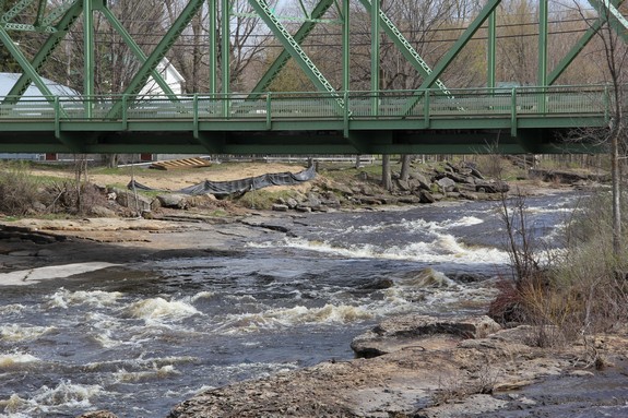
In the area of the bridge over the St. Regis River,
there is a narrow island in line with the current. The bridge
here is actually two sections. A steel girder bridge crosses
from the east side of the hamlet to the island and a smaller span
carries you across the 50 feet or so channel on the western bank.
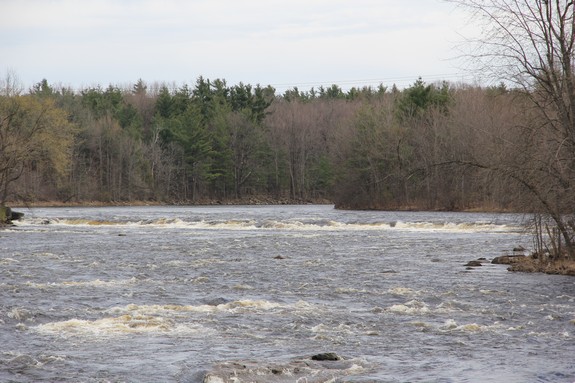
These rapids occur over a span of about 1500 feet above and below
the bridge. one of the larger drops in the section is close
to 1000 feet upstream from the bridge. The river is close
to 250 feet wide at that point and a very short curtain falls covers
the entire width at that point. It is difficult to judge because
it is so far away, but it would appear to be only about five feet
high.
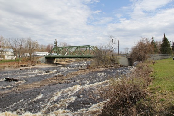
You can view this entire area from the bridge and there are also
a river access from the parking lot of a restaurant/bar on the river
bank at the southeast corner of the bridge. This eatery is
located on a side street that is about 300 feet long before it takes
a right angle turn away from the river. At that point, you
can see the upper drop but be advised that all of the property along
here is private property and in fact is signed as such. It
is apparent that the landowners here grew tired of waterfall "gawkers"
and posted signs to dissuade that practice.
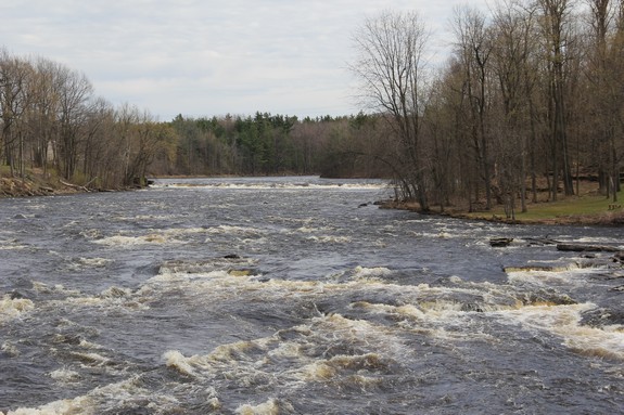
From this upper drop to the end of the stretch is a series of
rapids and small drops. About half-way between the upper drop
and the bridge is a another drop of about two feet. Just upstream
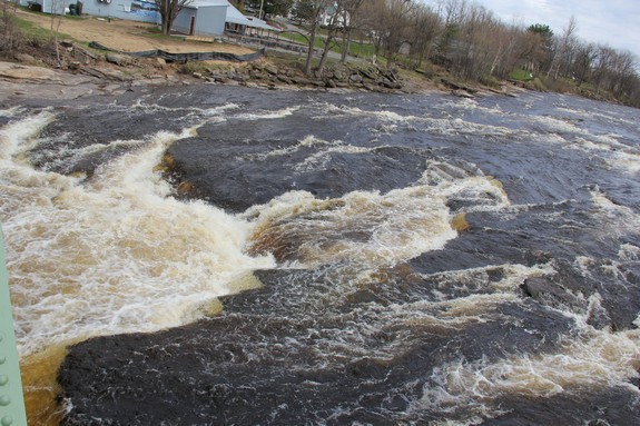
of the bridge in the main channel, there is a somewhat horseshoe
shaped drop. The volume of water coming through there is significant
which makes it look like rapids, but there is a five or six foot
plunge there. Below the bridge, the rapids continue around
a bend to river right.
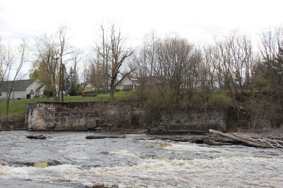
According to Terry Goodrich, a resident of that area, the falls
referred to here may also have been at an old dam just upstream
from the bridge. The concrete abutments are still there, but
the dam was washed out in a spring run-off in the 1930s. Mr.
Goodrich is also the one who informed us that the pictures we have
of what appear to be millstones are actually manhole covers that
a previous owner of the restaurant here cast in concrete and put
on display!
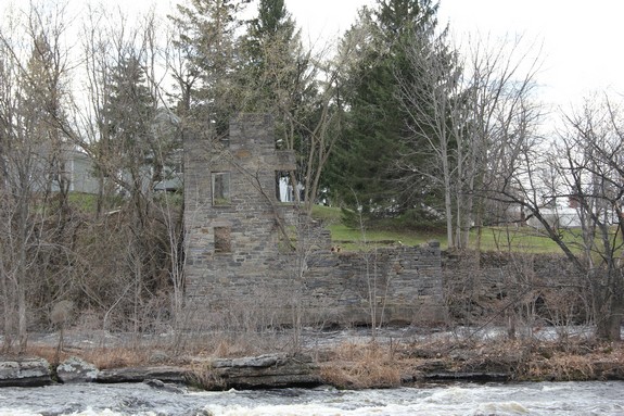
On the west side of the river, just upstream of the bridge is
the remains of an old stone structure, probably a mill that once
operated there. Another concrete foundation is on the shore
just upstream of that.
Our application was accepted on June 10, 2017 and this
waterfall is now listed on the USGS GNIS.
The St. Regis River flows into the St. Lawrence River almost
on the US/Canada border a few miles northeast of Massena, New York.
Last update: June 27, 2016
|