| Directions
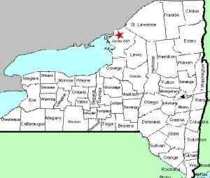
NY 37 runs primarily north-south from Watertown to
Morristown on the St. Lawrence River where it then
parallels the river and crosses the top of the state
until it ends in Malone, Franklin County. The
hamlet of Redwood is in the northern part of Jefferson
County. In this hamlet, Stine Road exits the east
side of 37. Almost immediately, Butterfield Road
exits right. Continue on this to the parking lot
for the Butterfield Lake Boat Launch site.
|
| County: |
Jefferson |
| Town: |
Alexandria |
| USGS Map: |
Redwood |
| Waterway: |
Unnamed waterway |
| Latitude: |
44o 17'
51" |
| Longitude: |
75o 47' 56" |
| Drop: |
35' |
| Type: |
Ribbon cascade |
| Region: |
North of Watertown |
| Parking: |
Unpaved lot |
| Trail type: |
NA |
| Length of hike: |
NA |
| Difficulty: |
NA |
| Accessibility: |
Probably private |
| Name: |
Unnamed |
|
Just south of where you turn onto Stine Road, an unnamed
creek flows from Mud Lake on the west to Butterfield Lake on the
east. From Route 37, this is difficult to see.
Although both lakes are visible, the creek itself must flow
through culverts under the higway.
Topographical maps show the distance between these two lakes
to be only about 0.3 mile. Some maps identify the body of
water just before Butterfield Lake as Crystal Lake, although we
feel that this is in error. Crystal Lake is about 1/4 mile
south of the boat launch. This body of water appears to be
more of a swamp or marsh.
When you enter the parking lot, proceed to the far, back corner. As you face to the right, with your
back to the lake, the falls will be on the hill about 1000' in
front of you. Note that it is probably only going to be
visible in early spring or late fall, when foliage does not
block your view. Our pictures were taken in late April.
Because of the distance from our vantage point, the foliage
and terrain that blocks the way and the angle at which we can
see the drops, your view of them is spotty at best. All
satellite views of this area that we could find were taken
during heavy foliage periods, so they don't shed any light on
it. We will surmise that these falls appear to split into
two parts as they come down the hill. The first photo
shows both drops. The second shot shows the lower portion.
The boat launch site appears to be town property. Much
of the property off the west end of Butterfield Lake is NYS DEC
land. Based on our research of local Internet Mapping
Applications, it appears that the waterfall itself is on private
property. The region between the west end of the parking
lot and the base of the falls is wetlands and not likely able to
be hiked. It is entirely possible that a canoe or kayak
could be used to get a closer view of the cascade but we did not
pursue that option.
Butterfield Lake flows north into Black Creek which empties
into Black Lake. This lake is a wide spot in the Indian
River which joins the Oswegatchie River before emptying into the
St. Lawrence River in Ogdensburg, New York.
Last update: April 29, 2022
|


