| Directions
From the north: Drive west from
the hamlet of Martinsburg on the Cemetery Road.
Take a left at the Alger Road. As you cross the
West Road, this becomes the Corrigan Hill Road.
Follow this until you cross a bridge over the Whetstone
Creek. Just past the bridge there is a parking
area.
From the south: Take NY 26 to
Houseville. Go west on the Houseville Gulf Road
(not the Houseville Road). The first right will
be the Corrigan Hill Road. The parking area is
on the left just before the bridge.
|
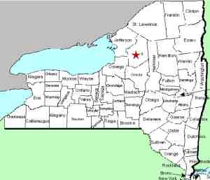
| County: |
Lewis |
| Town: |
Martinsburg |
| USGS Map: |
Page |
| Waterway: |
Whetstone
Creek |
| Latitude: |
N 43°
41' 47" |
| Longitude: |
W 75° 29'
48" |
| Drop: |
50' |
| Type: |
Plunge |
| Region: |
Northwest
of Turin |
| Parking: |
Unpaved lot |
| Trail type: |
Dirt |
| Length of
hike: |
1/2 mile |
| Difficulty: |
Moderate |
| Accessibility: |
Public |
| Name: |
Common |

|
The Whetstone Gulf State
Park is home to the Whetstone Gulf Falls. Athough it is
possible to hike the trail around the rim of the gorge, that is
somewhat of a lengthy walk. We also know of people who
have hiked up the creek trail.
This path requires sections where you must walk in the creek.
At certain times in the year, the amount of water flow may
prevent this. This route detailed in the directions bar not
only is shorter, but it avoids the day use fee for the park, $7 in 2010. The trade-off is that you
probably want to be in a 4-wheel drive vehicle of some type which
ample clearance. The roads you take to get to the trailhead
are not paved. During the summer, the ride probably won't
be bad but in the spring, your vehicle will undoubtedly look
like you've been mud bogging by the time you are through.
At the parking area, take the north ridge trail if you want to
walk right up to the falls. The south ridge trail allows you
a view across the gorge. Both trails are well maintained and
about a 15 minute walk of moderate difficulty. Be aware
that both of these trails are easily passable, but the foliage
can become an issue, especially during the summer.
This waterfall is the most significant drop in this area.
We call it the Whetstone Gulf Falls and it is formed on an
unnamed feeder of the Whetstone Creek which flows through the
gorge. You will see a number of smaller
waterfalls on this creek as you hike in.
We have posted some of these on a separate page for Whetstone
Creek Falls. A contributor has submitted pictures of these
from a hike along the base of the gorge.
The Whetstone Creek flows into the Black River, which flows to
Lake Ontario in Dexter, New York.
Last update: November 2, 2017
|


