| Directions
At the intersection of NY 12 and NY 28 at Alder
Creek, drive east. In Woodgate, turn right onto Bear Creek Road. Drive to the end of the road
where you will find a parking area.
|
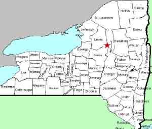
| County: |
Herkimer |
| Town: |
Ohio |
| USGS Map: |
McKeever |
| Waterway: |
Woodhull Creek |
| Latitude: |
N 43°
33' 32" |
| Longitude: |
W 75°
00' 21" |
| Drop: |
10' |
| Type: |
Slide |
| Region: |
East of
where Herkimer, Lewis and Oneida Counties meet |
| Parking: |
Unpaved lot |
| Trail type: |
Dirt |
| Length of hike: |
6 miles, one-way |
| Difficulty: |
Moderate |
| Accessibility: |
Public |
| Name: |
Common |
|
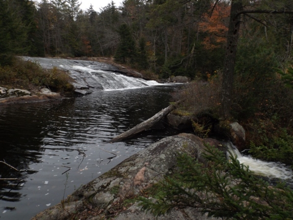
We have
not been to this waterfall. Our photographs were submitted
by a contributor. There are a couple of popular trails to
it so, rather than reinvent the wheel, we will direct you to the
CNY Hiking website for directions.
USGS
topographical maps of this area label two "Falls". This
waterfall is
the more downstream of the two. Although remote, it
is a fairly popular waterfall destination. Several on-line
sources show pictures of this drop.
Normally, we would
post a page for this waterfall with the notation that there are
additional, incidental falls upstream of it. In this case,
we are creating pages for the other two as well because they are
noted on maps.Woodhull Creek flows into the Forestport Reservoir which is
on the Black River. The Black flows into Lake Ontario at
Dexter, just west of Watertown.
Last update: November 9, 2017
|