| Directions
Located on NYS Route 73, this site is just south of the
hamlet of Saint Huberts, which is on the stretch between
the village of Keene Valley and the northern intersection
of routes 73 and 9. Look for the signs for the Giant
Mountain Wilderness Area. The parking area for AMR
is directly across the road.
|
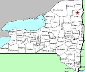
| County: |
Essex |
| Town: |
Keene |
| USGS Map: |
Keene Valley |
| Waterway: |
Ausable River, East Branch |
| Latitude: |
N 44° 08' 59" |
| Longitude: |
W 73° 46'
04" |
| Drop: |
Multiple |
| Type: |
Multiple |
| Region: |
Off NY 73 near the hamlet of St. Huberts |
| Parking: |
Unpaved parking lot |
| Trail type: |
Dirt |
| Length of hike: |
Varies |
| Difficulty: |
Moderate to difficult |
| Accessibility: |
Access by easement |
| Name: |
Some official/some common |
|
The Adirondack Mountain Reserve is the home of the Ausable Club,
a private and fairly exclusive organization. The AMR was formed
in 1887 to preserve the mountain area from the lumbering industry
and as a game preserve. As a game preserve, they do not allow
dogs on the premises. This prohibition is a longstanding one
and is strictly enforced. It is also home to the Adirondack
Trail Improvement Society (ATIS), which developed and maintains
many of the trails into the Adirondack high peaks.
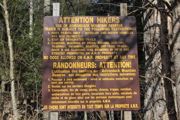
Although hunting and fishing is prohibited within the AMR, easements
are in place allowing access to trails to the high peaks area.
There are, however, several restrictions. When we were there
in April 2012, there were signs prohibiting things like cell phones,
blackberries, PDAs and headphones for music players. It is
our understanding that these signs have been removed, so if you
are coming into this facility, make sure you read the regulation
signs.
The trailheads to many of the high peaks are accessed through
this property. Armstrong Mountain, Basin Mountain, Dial Mountain,
Gothics, Lower Wolfjaw Mountain, Mount Colvin, Mount Haystack, Mount
Marcy, Mount Skylight, Nippletop Mountain, Noonmark Mountain, Round
Mountain Saddleback Mountain, Sawteeth and Upper Wolfjaw Mountain
are all here. In addition, waterfall lovers will find a number
of beautiful falls here.
Since the access of all of these falls are from the same place,
we have opted to provide this page for the common information.
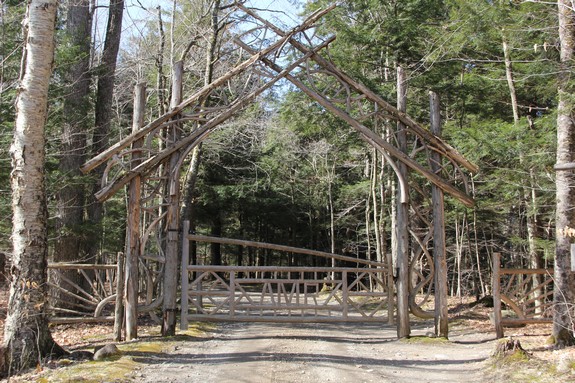
There are separate pages for each of the falls. From the parking
area, you start with about a half-mile walk up the road to the club
grounds. As you approach the St. Hubert's Inn, the property
clubhouse, the Lake Road will be on your left. There is a
tennis court on that corner. 0.15 mile from this corner, there
is a gate house where you will need to sign the register.
You are only a few hundred feet from the Ausable River's East Branch
at this point.
IMPORTANT UPDATE ... On May 3, we were
contacted by Tony Goodwin, with the ATIS and several other
Adirondack related organizations. Effective this year
(2021), "there are more restrictions - specifically the need for
a reservation between May 1 and October 31. The good news is
that a reservation guarantees a parking space whenever one shows
up, but this reservation must be made at least 24 hours in
advance and not more than two weeks in advance. Reservations
can be made at:
hikeamr.org." Please note that this is not just in
regard to the waterfalls within the AMR. It includes "any peak accessed from the Ausable Lake Road plus Noonamark and
Round Mts, if accessed from the AMR trailhead." The Ausable flows from the southwest to the northeast through
this valley. The East River Trail and Lake Road provide access
to the side on which you enter and the West River Trail traverses
the other side.
It is important to note that all of the named waterfalls in the
reserve are actually on tributaries of the Ausable's East Branch.
There are dozens of cascades on the Ausable. This section
of the river is literally one waterfall after another. Many
of them are small, but some of them are significant. There
were so many that we decided not to include all the pictures we
took. one particular waterfall however, was very nice and
we took so many pictures of it, we decided to include a separate
page. It was the biggest waterfall we saw that was actually
on the Ausable. We saw it from the West River Trail but it
is our understanding it is better seen from the East River Trail.
It is the only waterfall visible from that side.
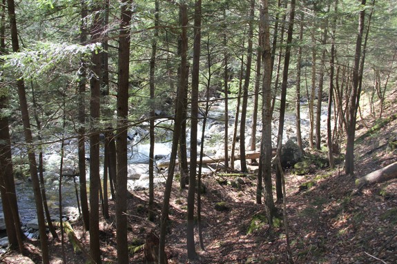
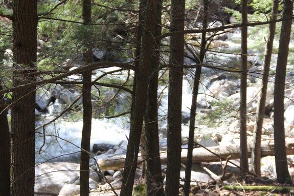
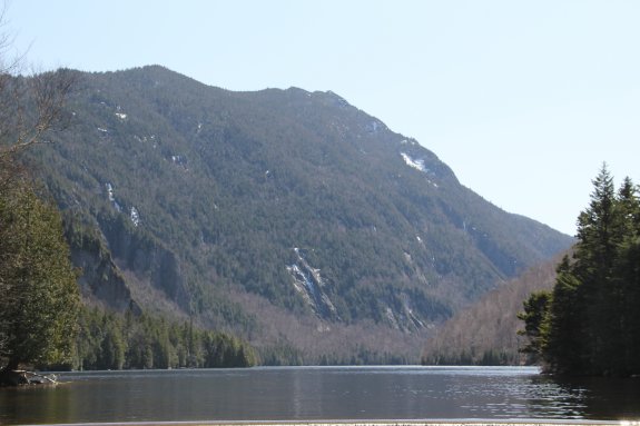
The pictures on this array are of sights we saw on the hike.
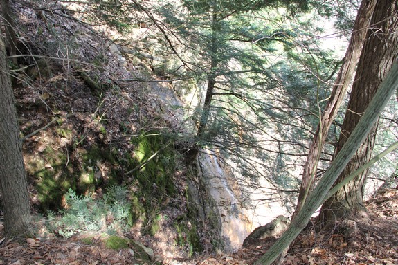
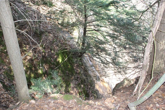
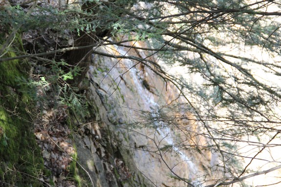
The first three after the picture of the trail marker are of an
unnamed waterfall that is on a creek that is so small it isn't even
on topographical maps. There probably isn't much more water
coming down here then the average garden hose might put out, but
the drop is impressive. It comes over a number of rocks and
then through a small opening and then down ... straight down, a
sheer rock wall. The pictures of this aren't that good, but
the landscape didn't really allow a good vantage point. This
is on the West River Trail between the outlets of the Pyramid Brook
and the Wedge Brook.
It is a personal decision as to how many of the falls you choose
to visit. Due to the intensity of the hike to get to these
locations, it makes a lot of sense to take in several of the locations
at once, rather than make a separate trip for each one. After
all, you literally walk by three major waterfalls on the West River
Trail to get to Rainbow Falls. Attempting all on one day would
be a monumental effort but has been done. We recommend
that you make two trips, one for each side, and that is how we have
set up the directions for each waterfall. Please note that
it is still a healthy work-out to do it this way.
West River Trail ... From the gate house, take a right.
You will cross a footbridge to the West River Trail. From
here, you will find trails to
Pyramid Falls,
Wedge Brook Falls,
Wedge Brook Cascades,
Beaver Meadows Falls and
Rainbow Falls.
You will also see the unnamed falls on
the Ausable between Wedge Brook and Beaver Meadows Falls.
East River Trail ... This trail follows the river, although in
most spots, you are high above it. It is a rigorous hike but
if you are looking for waterfalls, not the best route. Whereas
the West River Trail takes you to the above mentioned trailheads,
the trailheads on this side of the river are more easily accessed
by the Lake Road. If you do choose this route, follow the
Lake Road past the guard house until you get to signs directing
you to the East River Trail.
Lake Road ... Going straight at the guard house will take you
to the trailhead for Gill Brook, which contains
Gill Brook Steps,
Gill
Brook Flume and Artists
Falls. Fairy
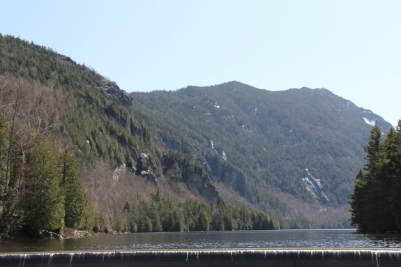
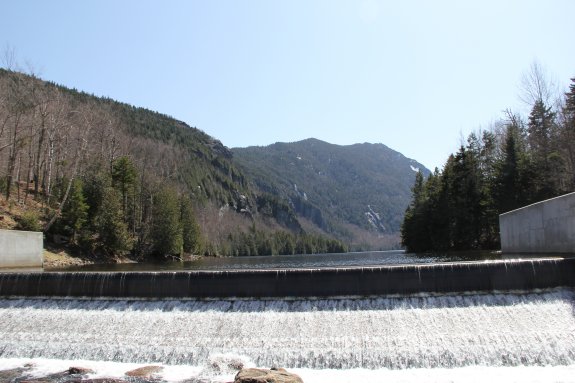
Ladder Falls is further up this trail. An alternative
is to cross the footbridge at the base of the dam at Lower Ausable
Lake after you view Rainbow Falls. When you get to Lake
Road, Fairy Ladder Falls is further up to your right. The
Gill Brook locations will be to your left on
the way out. As previously mentioned, taking in all the falls
on both sides would make for a long day.
The East Branch of the Ausable River joins forces with the west
branch downstream at Au Sable Forks to form the Ausable River.
This waterfall rich river empties into Lake Champlain in the town
of Peru.
Last update: May 3, 2021
|