| Directions
Just north of the village of Croghan, the Belfort Road
exits NY 812. About 0.7 miles up this road, take a
left on the High Falls Road. In about 1-1/4 miles,
the road will bend left. In another 1/4 mile or so,
the road will take another left. Keep following this
to the power plant where you can park.
|
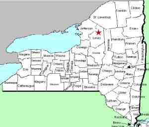
| County: |
Lewis |
| Town: |
Croghan |
| USGS Map: |
Belfort |
| Waterway: |
Beaver River |
| Latitude: |
N 43o 55' 29" |
| Longitude: |
W 75o 22' 25" |
| Drop: |
~80' |
| Type: |
A series
of slides and cascades |
| Region: |
East of Croghan |
| Parking: |
Unpaved lot |
| Trail type: |
Dirt |
| Length of hike: |
5 minutes |
| Difficulty: |
Easy |
| Accessibility: |
Public |
| Name: |
Common |
|
To refer to High Falls in northern New York doesn't really narrow
it down! In addition to this one on the Beaver River, there
are two others in Lewis County. One of these is west of this
one on the Deer River in Copenhagen
and the other just a few miles away
on the Oswegatchie
River West Branch, also in the town of Croghan. There
is a second High Falls
on the Oswegatchie, this one on the main channel in the town
of Fine. If that weren't enough, there are at least ten others
scattered elsewhere in northern New York.
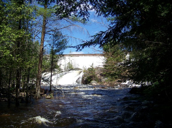
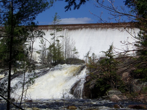
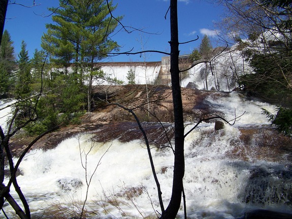
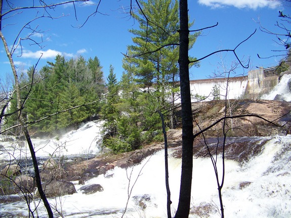
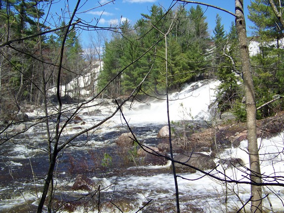
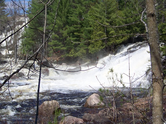
From the parking area, walk up the penstock toward the dam.
There are several places that you can walk under the penstock and
follow the river upstream. Once you reach the river, you won't
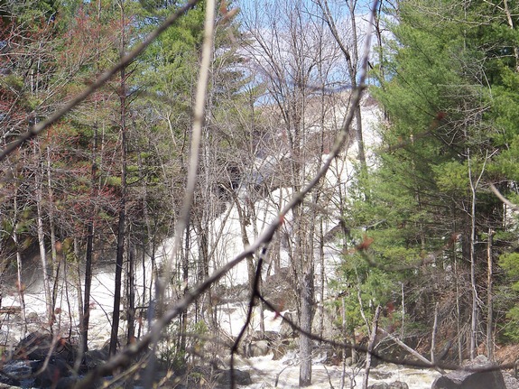
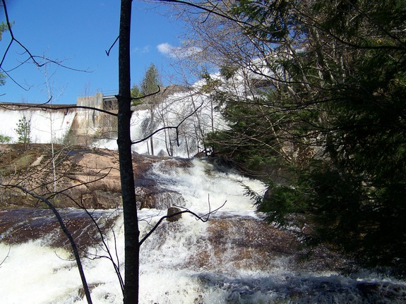
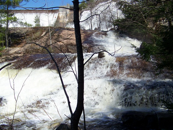
have any problem finding the falls. This dam is enormous,
at least by northern New York standards. We don't have any
specific data to support this other than observation, but this dam
has to be one of the largest in northern New York. It has
to be close to 800' in length across the river. Below the
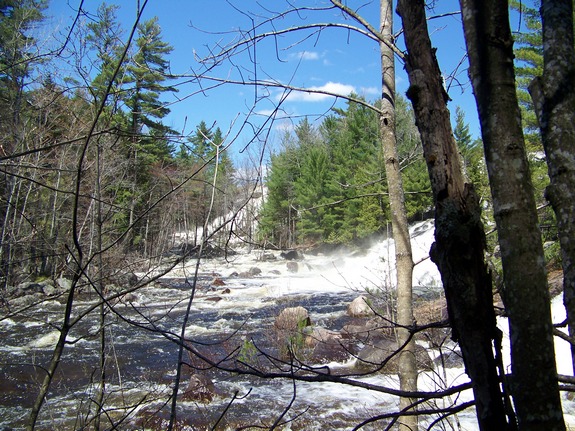
dam there is a waterfall spanning the width of the river.
We were there in mid-May and with the spring run-off from the
Adirondacks above, water was pouring over the entire span.
The Beaver River flows into the Black River, which empties into
Lake Ontario at the Black River Bay, just southwest of the village
of Dexter.
Last update: July 28, 2015
|