| Directions
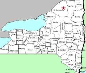
The hamlet of Colton is located on NY
56, a few miles east of Potsdam. At the intersection
of Main Street, proceed northeast. There are two parking
areas. The first is on the left just before crossing
the bridge. For the second, which is the preferred
route for waterfalls, take the left after crossing the bridge.
There is a lot immediately behind the fire hall but you
want the lot past that.
|
| County: |
St. Lawrence |
| Town: |
Colton |
| USGS Map: |
Colton |
| Waterway: |
Raquette River |
| Latitude: |
N 44°
33' 20" |
| Longitude: |
W 74°
56' 20" |
| Drop: |
Multiple |
| Type: |
Multiple |
| Region: |
Off NY 56 near
Colton |
| Parking: |
Unpaved parking
area |
| Trail type: |
Dirt |
| Length of hike: |
Varied |
| Difficulty: |
Moderate |
| Accessibility: |
Public |
| Name: |
Common |
|
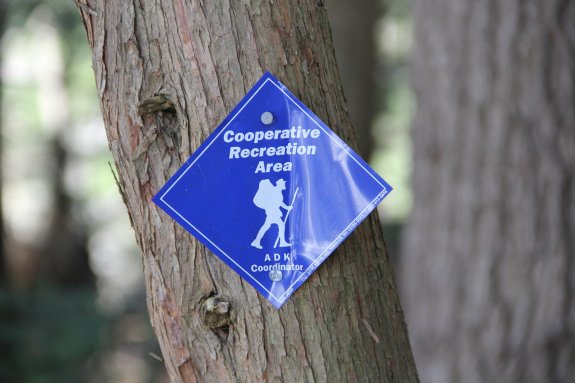
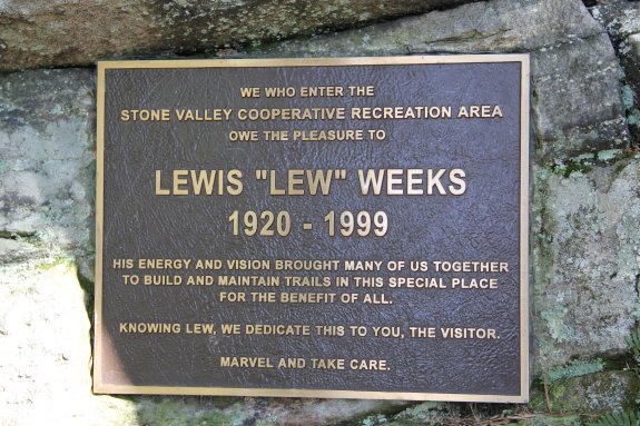
The Stone
Valley Cooperative Recreation Area is located on property owned
by Brookfield Power, although a small portion of it is on Town of
Colton land. The trail network here, which is well marked
and fairly well maintained, is undoubtedly the most popular nature
trail in St. Lawrence County, if not the entire north country.
Publicly accessible, and free to do so, the area offers hikers,
waterfall lovers, kayakers and rock-hounds a place to remember.
Since the access of all of these falls are from the same place,
we have opted to provide this page for the common information.
There are separate pages for each of the falls. Please note
that although this area is legally named as the Stone Valley Cooperative
Recreation Area, we consider this a common name since it is not
registered on the USGS GNIS. Likewise, none of the falls here
are officially named. Most get their names from the whitewater
community.
There are actually two trails through this area. our preference
for seeing the waterfalls is the trail that runs from south to north
up the east side of the river. The trailhead parking for this
is behind the fire hall as described in the directions side-bar.
The west side trail will also give you access to the river and views
of the falls. It is probably debatable, but we just feel that
the waterfall views are a bit better from the east side. This
is also the best route for those looking for the shortest path to
see the waterfalls. There are also parking areas on both sides
of the river at the northern ends of the trails. These are
accessible from the Brown's Bridge Road, about 3 miles on the Potsdam
side of the hamlet of Colton.
A couple of hundred feet in from the parking area behind the
fire hall is a registration kiosk. The hike from here is "vigorous."
Multiple ascents and descents make the trip moderately strenuous
and will give you a good cardio workout. of course, you can
make the trip at a leisurely pace. There are plenty of vantage
points and places to rest. To see the falls, you are looking
at about a 3-1/2 mile walk. The only disadvantage with this
route is that the falls are over your left shoulder as you walk
in. Of course, you are facing the flow on your return.
You will pass, in order, Colton Dam,
Colton Falls,
The Bubbler, an unnamed drop we refer to as
Stone Valley Falls, the Narrows,
the Tubs and Lucy's
Hole. The rest of the trail is along fairly level water.
For those out to view the waterfalls, you have hiked about a mile-and-a-half
by the time you get to Lucy's Hole. Most people find they
see sights on their return trip that they missed on the way down.
For those looking for a longer hike, there are several options.
Both the east and west trails are promoted as being 3.2 miles.
You can complete part or all of that and then return for a total
trip of just under 6.5 miles. If you're looking for something
even more, the two south trailheads are a little less than 1/2 mile
apart while the north trailheads are just under a mile from each
other. If you complete either trail, cross the river and return
on the other side, you have covered about 7.8 miles.
This area is enjoyed by many during all four seasons. It
is a relatively untamed area and there are no fences or rails separating
you from the river. This is especially noteworthy in the winter
when the ice and snow make things very slippery. In the spring,
the water volume is intense. During periods of lower water
in the summer, several swimming holes beckon.
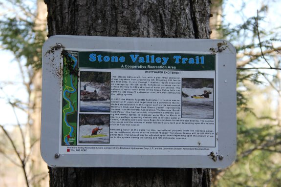
Maps of the area are available at registration kiosks.
There are also informational signs along the way that describe the
section or perhaps the geology of the area, which is somewhat unique.
The Raquette River empties into the St. Lawrence River in Massena,
New York.
Last update: August 25, 2016
|