| Directions
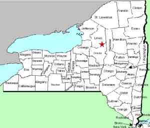
Talcottville is on New York State
Route 12D, about 2 miles north of Boonville. Park
on the roadside in the southbound lane, just south of
the bridge crossing the Sugar River.
|
| County: |
Lewis |
| Town: |
Leyden |
| USGS Map: |
Port Leyden |
| Waterway: |
Sugar River |
| Latitude: |
N 43o
32' 07" |
| Longitude: |
W 75o
22' 05" |
| Drop: |
~60' |
| Type: |
Rectangular
Block |
| Region: |
Northwest
of Boonville |
| Parking: |
Roadside |
| Trail type: |
Dirt |
| Length of
hike: |
2 minutes |
| Difficulty: |
Easy |
| Accessibility: |
Public |
| Name: |
Common |
|
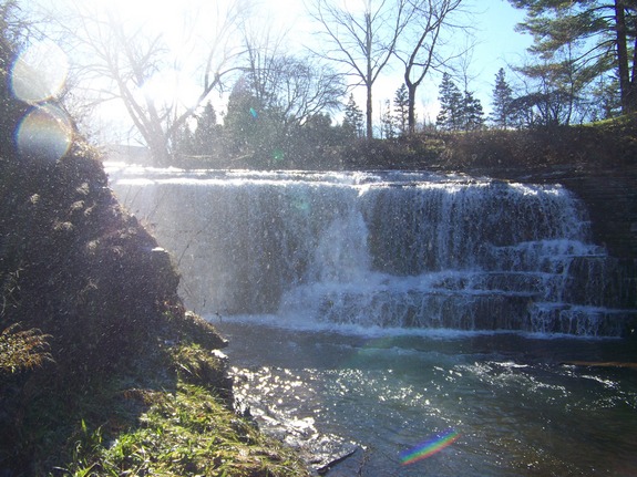
 In the southbound lane,
just past where the guardrails end, you will find a path that leads
to the falls. According to local sources, these falls are
technically unnamed. Since they are not indicated on topographical
maps, that would substantiate that. We have seen them referred
to as Talcottville Falls and Sugar River Falls. Since information
we have been given indicates that there are a number of other falls
on the Sugar River, we will go with the former. Please do
not confuse these with
Talcott Falls on the Stony Creek. This is one of the two most
popular falls in nearby Jefferson County. In the southbound lane,
just past where the guardrails end, you will find a path that leads
to the falls. According to local sources, these falls are
technically unnamed. Since they are not indicated on topographical
maps, that would substantiate that. We have seen them referred
to as Talcottville Falls and Sugar River Falls. Since information
we have been given indicates that there are a number of other falls
on the Sugar River, we will go with the former. Please do
not confuse these with
Talcott Falls on the Stony Creek. This is one of the two most
popular falls in nearby Jefferson County.
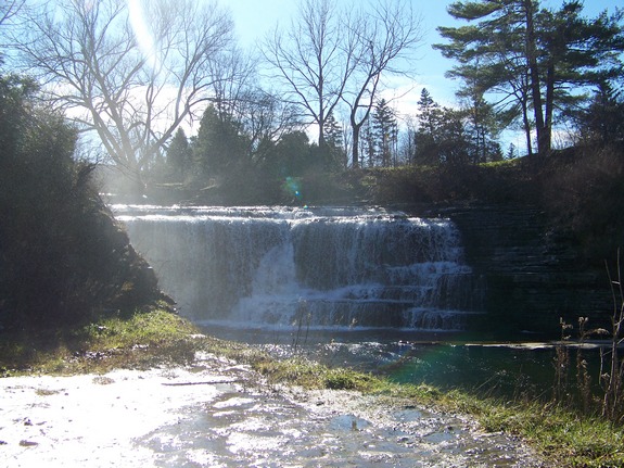
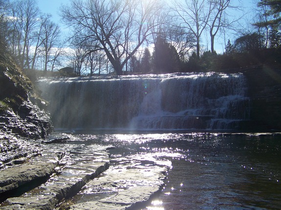
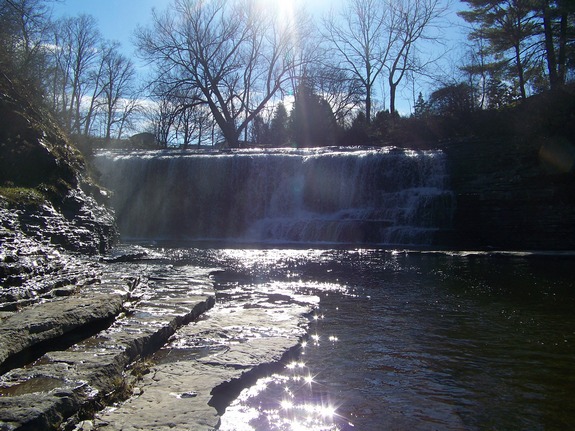
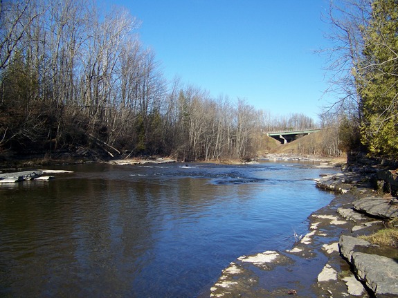
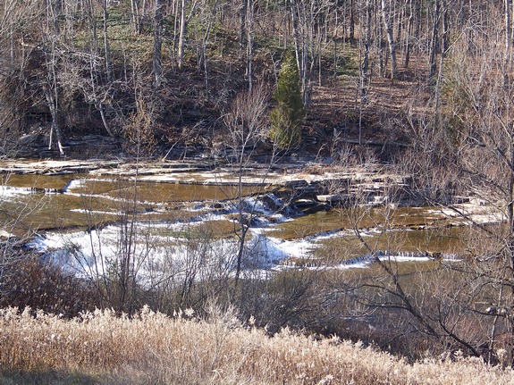
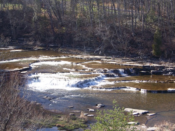
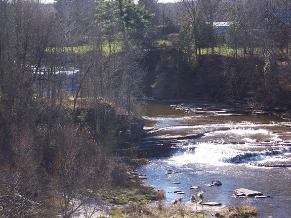
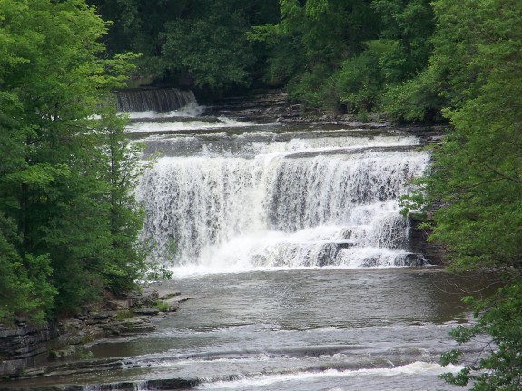
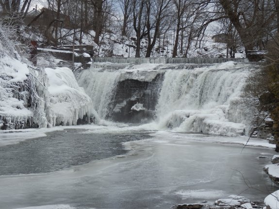
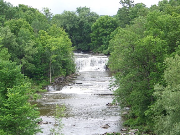
There is actually a series of drops here. Just downstream
of these falls, between the falls and the highway, is another smaller
drop. This section could qualify as a waterfall on its own
since it is actually as large or larger than other named waterfalls
in northern New York. It is closer and more visible from the
highway. Pictures of this are also included in the display.
In the last photo in the display, the main and lower falls can be
seen in relation to one another. Also, just above the main
falls, there is a drop of several feet that might lead one to classify
this as a step waterfall.
As an interesting side-note, the hamlet of Talcottville is the
first settlement in Lewis County.
The Sugar River flows into the Black River just a few miles downstream
from these falls. The Black River flows into Lake Ontario
in the Jefferson County community of Dexter, just west of Watertown.
Last update: April 24, 2017
|